We made way early because a small craft advisory was called for by noon. So we got underway with 2 other loopers (Glory Days and Dockers Inn). Both of those boats pulled into Whitehall, but we pushed on to Muskegon and got there before the winds and waves came up at noon. We laid over here for 2 nights due to the weather forecast. Muskegon is a commercial boom and bust city. Essentially, the lumber that built Chicago came from here. There were 42 sawmills here. Now, this city is transforming toward tourism. We took tours of the town. It has a great beach and the water is clear—as good as any we saw in Hawaii, except we would not want to be on the beach here in the winter. The first pic shows a statue of Buster Keaton, the silent film actor who came from here. The next pic shows the Hackley and Hume homes that we toured that had some of the finest wood craftsmanship we have ever seen. Then a pic of a picture of Pigeon Hill, a huge sand dune, where the passenger pigeons once inhabited until they became extinct. I cannot take a pic of Pigeon Hill now because they used it to make cement back in the 1970’s.
This site documents the journey by Larry and Christine Hayden around America's Great Loop aboard the motor vessel Blue Skies
Monday, August 29, 2011
August 26 Underway finally
We were underway at 0515 in the morning. It was pitch dark, but a fishing tournament was happening that day and it would be extremely conjested in the harbor at daylight, so we wanted to beat the fisherman out of the harbor. But it was still crowded ! We had to wait to get in line as a steady stream of boats poured passed us into the channel. Before leaving Frankfort, the first pic shows swans diving for fish—which we saw many times—swan butts. Of course the journey to Pentwater was not without some excitement as we ran into a commercial fishing operation as they were running their nets. The next 2 pics shows the commercial tug and an able bodied fisherman diving to cut some lines. But we arrived in Pentwater early. The last pic shows how seriously they take fishing on Lake Michigan.
Wednesday, August 24, 2011
August 23, 24, ??? Stuck in Frankford
We are in Frankford until the winds and waves calm down. I am checking how the weather service calculates wave heights. It turns out that it is the square root of an average, but in a practical sense, it means that waves of 2 to 4 feet means there will be waves much higher than 4 feet. For example, when 2 to 4 feet seas are forcasted, then 1 of every 10 waves will be at least 5 feet (about every 2 minutes). And 1 of every 100 will be at least 6 feet (about every 12 minutes). Finally, 1 of every 1000 waves will be at least 8 feet (about 120 minutes). Waves are forcasted up to 8 feet, and that means constantly encountering 9 and 10 foot waves, with an occasional 16 footer to deal with. There are 5 other loopers stuck here in Frankford until the waves and wind lay down. So, we rotate happy hour from 5 to 7pm on our boats, each day on a different boat. Other than that, we are riding bikes and doing boat chores. The pic shows the vessel Edmund Fitzgerald that sank on the great lakes. We now know why!
August 22 On to Frankford
We met other loopers in Leland and discussed the wave height situation for the next day. It was supposed to be calm in the morning and then pick up in the afternoon. However, we found that the forcasts were incorrect for the lake many times. Anyway, we got underway about 0630 in order to arrive in Frankford before noon. The forecast was right. It was calm during our trip and then the waves picked up by noon. During the trip, we passed Sleeping Bear Dunes, which was recently voted the most scenic spot in America by Good Morning America. (2 pics). The next pic has us coming into the harbor at Frankford.
August 21 Another grueling ride to Leland
We started early but had to wait for the bridge opening at Charlevoix. We were back on Lake Michigan by 0730 hrs. All went well till about 0900. The waves were supposed to be 2 to 3 feet by the afternoon, but we were already seeing 3 foot waves by mid-morning. Our trip plan had us arriving in Leland at 1100 hrs, but it was going to be much later. The waves were building quickly and we had to steer into the waves a 45 degree angle, which took us off course in a westerly direction toward the middle of the lake. By 1100 hrs the VHF radio was blaring with boaters looking for safe harbor. We zigzagged our way to Leland by 1200 hrs and just rested for awhile. Leland has a section of town, called Fishtown, preserved as commercial fishery that can still be accessed by the public. The first pic shows a commercial fisherman cleaning nets. The next 2 pics shows Fishtown today and what it was like in 1910. We bought fresh Whitefish in Fishtown and grilled it on the boat. Best ever.
August 20 Charlevoix – another gem on Lake Michigan
The winds were calm at 0700 hrs and we headed out of Little Traverse bay to Charlevoix. We purposely set our trip plan to be short because we did not want to get caught in those Lake Michigan waves again. But the winds were light and waves had laid down, so we arrived in Charlevoix around 10 am. It is beautiful town on a small lake just off of Lake Michigan. It was a sunny Saturday and lots of boaters were on the water. You could even get a hot dog on the water (first pic). We took a nice long bike ride on a well groomed path. The next pic shows a boardwalk constructed for more than a mile in order to preserve marsh grasses. We ended the ride in Charlevoix and checked out the mushroom houses. About a dozen houses were constructed to look like mushrooms (3rd pic).
Friday, August 19, 2011
August 19 Another crew gone from BlueSkies
Petosky was a fabulous small town. Amy and Steve left in the morning (pic below) to get their car and start the long journey back to Asheville, NC. Chris and I spent most of the day on chores, but managed to fit in a long bike ride that went around Little Traverse Bay. It was another day of high winds and we are wondering what the cruising will be like for the next 2 weeks on Lake Michigan – where the wild winds blow.
August 18 The jump to Petosky
Our first bad weather day while underway. A long 7 mile trip with up to 5 and 6 foot waves. The pic below shows Steve on his knees. The only way to get around the boat was to crawl due to the rocking and rolling of waves. Whitecaps the whole way. By nightfall, we were in safe port at Petosky (pic 2).
August 15, 16, 17 Going back in time at Mackinaw Island
We headed out of Drummond Island and headed for Mackinaw Island. On the way, we past the lighthouse at De Tour Village and saw folks who stay on the lighthouse day and night (first pic). It was a nice crossing on the last part of Lake Huron and we started into Makinaw Island. The next pic shows the Grand Hotel from the water on our approach to the island. The next day, the crew of BlueSkies headed out to explore the island (third pic). We biked around the island and one of the great scenic areas is Arch Rock (fourth pic), which shows the incredible rock formations on the island. Another key feature of the island was crystal clear water. The fifth pic shows Amy and Chris taking a swim in that unbelievable clear water. One of the great attractions of Mackinaw Island is that NO CARS are allowed on the island. So only bikes and horses provide transportation ! Pic 6 shows the delivery horse and wagon for the pharmacy and grocery store. We went to Ft Mackinaw, which was a great historic site but nothing of real significance happened there. Anyway, there was a lunch spot and we spotted a waiter, Rudy, who delivered lunch and drinks on a tray balanced on his head (pic 7)
August 13-14 Blind River, Ontario and then BACK to the USA !!
It was rainy in Blind River. We continued to do chores while waiting for the next crew of BlueSkies to show up. Steve and Amy showed around noon, and, with the weather and late start, we decided to stay at Blind River for the nite. We witnessed some local color at a nearby bar –Jean as 78 year old who was very sharp, even after a few beers, and told us her entire 78 year story. The next morning we were off to the USA at Drummond Island. The first pic shows the new crew of BlueSkies enjoying the trip crossing the North Channel toward Drummond Island. Then next 2 pics are me at Drummond cooking and Steve and Amy at the marina. We went through customs just fine, so, we were BACK IN THE USA!
Saturday, August 13, 2011
August 12 Crossing the North Channel
We headed out for long day to cross the North Channel in order to get Blind River, where another crew for BlueSkies is scheduled to show. The pic below shows the lighthouse at Clapperton Island Channel as we headed out for the open waters on the channel. We arrived in Blind River and spent the afternoon on chores.
August 11 Kagewong
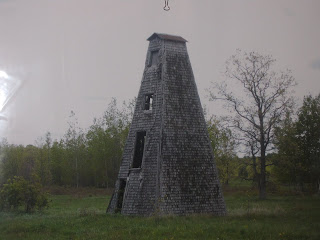
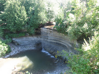
We arrived in Kagewong in 20 knot winds, but all went well with docking. Kagewong is one of the few towns that retained its aboriginal name, which means the mist of falling waters (first pic). We hiked around the township. The second pic shows a structure used to raise fox and mink for commercial sale of furs. The third story of the tower was used to dry the furs. We also hiked to Bridal Veil falls (third pic). And the pic is Chris as we walked along the Kagewong river.
Wednesday, August 10, 2011
August 9-10 The largest freshwater island in the world
We made way for Little Current for the town docks early because stormy weather was forecast starting in the afternoon. There we met with Roy Eaton who sponsors the Crusiers Network. Every morning on VHF 71, Roy broadcasts the news to cruisers and then all boats in the North Channel of the Georgian Bay call in thier location so, for safety reasons, our boats can be tracked. We met Roy at the AGLCA meeting in Norfolk back in May and invited him to the boat. The first pic is Roy onboard with several other loopers who docked up next to us. The next morning, we visited Roy at the broadcast studio and listened to the broadcast live (second pic). The last pic shows a sign about the Manitoulin Islands, which (the sign said) was the largest frest water island in the world. It was stormy and very windy today, so we stayed put.
August 7-8 A water wilderness, Baie Fine
We headed out of Killarney, and passed another BlueSkies (first pic) who we met. The owner was friends with the person we bought our boat from and he was estatic that our BlueSkies was seeing some of the best cruising grounds in the world. The weather forecast called for rain and and windy weather, but our destination was about 2 hours away and we planned to anchor in a safe, well protected area call Baie Fine (pronounced Bay Finn). This is one of the premier scenic areas of the Georgian Bay. It is a fjord, which is is a long, narrow inlet with steep sides or cliffs, created in a valley carved by glacial activity. We found a nice cove and anchored up. Then, started exploring the fjord using the dinghy. Luckily the weather had turned nice. At the end of the fjord is "The Pool", where we beached the dinghy and hiked up the rocky cliffs to the top. There we peered out over Topaz Lake, a beautiful primitive lake named for its greenish-blue color (second pic). After a short swim, we hiked back down and headed back to BlueSkies. We past only one cabin. It was owned by Evenrude, who created the outboard motor. Every summer, he would bring his ship (115 foot) from Fla to Baie Finn and power the cabin using the boat !
The next day was a crisp, clear summer day. We decided to just stay in Baie Fine.
The next day was a crisp, clear summer day. We decided to just stay in Baie Fine.
Sunday, August 7, 2011
August 6 Killarney - At the North Channel
We needed to cross a large expanse of Lake Huron in order to make it to the North Channel. So, we started early today because the weather is supposed to turn over the weekend. After traversing the open water, we came the Collins Inlet, which (they say) is one of the top ten scenic passages in the world. The first 2 pics show some views as we are making way through the passage. The next pic proves that we made it to Killarney, the beginning of the North Channel ! At Killarney, a famous take-out eatery for fish and chips is called Herberts, where the serve up fresh caught fish out of an old school bus (next pic). We hiked to the lighthouse, and visited the one street town of Killarney. I was washing the boat at the dock, and floatplanes just come right by (last pic). The planes carry tourists though Killarney harbor and then take off for the next sight to see.
August 5 Anchored at the Bustard Islands
We reluctantly left our anchorage at Point Au Brialle and headed west toward the North Channel. The first pic shows the many rock outcrop passages that has to be traversed all along the south channel of the Georgian Bay. We arrived at a small cove between Strawberry Island and Tie Island, in a group of islands called the Bustards. It was beautiful. The water is crystal clear- the next pic proves that, you can see my toes in the water! We kayaked among the islands to explore them. Peaceful night.
August 4 To the Lantern on the Barrel- Point Au Brialle
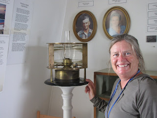
Point au Brialle was named for a barrel with a lantern on it that showed the way for traders in the late 1800’s. So, we went looking for a barrel with lantern on it, now replaced with a lighthouse built in 1883. We anchored in a nice cove about 3 miles from the lighthouse and took the dinghy down the channel to the lighthouse (first pic). We found Emmaline Madigan (pic 2), who lived at the lighthouse starting at age 17 and was the lighthouse keeper for 29 years. During that time she raised 6 children in the lighthouse. She works now as a guide for the lighthouse, but lives there 5 days per week. Pic 3 shows Christine with the original lighthouse lantern and the Fresnel lense. Pic 5 show a replica of the original barrel where the lantern glowed in the mid 1800’s. Finally, a shot from the top of the lighthouse. We returned to our anchorage sanctuary and had a peaceful night among granite outcrops and crystal clear water.
Subscribe to:
Comments (Atom)


